

Strategic Project for Odemis District in 2040...
This is a project for another district of Izmir; Odemis. The project is about developing the area and preparing it for the year 2040. This project includes some spatial analyses and a sythesis, some propasal scenarios and one last proposal for the area.
Odemis is agriculture-based district. It located in very fertile basin and is one of the most important districts for Turkey in case of having agricultural product.
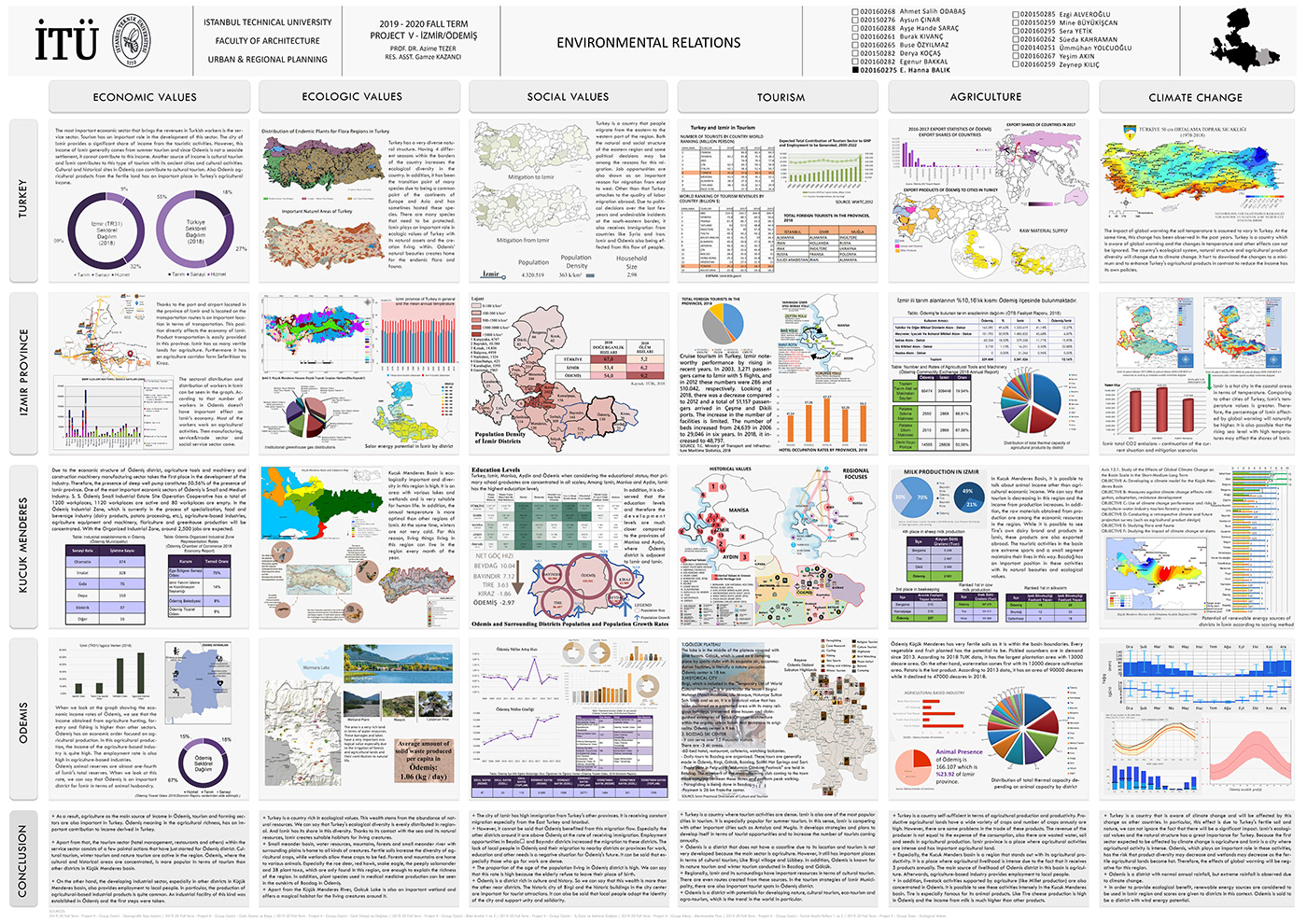
This poster is the environmental relations for Odemis. What does it mean for Turkey, for Izmir and for Kucuk Menderes Basin? There are many information categorized and maps and charts for the area

This is the SWOT analysis covering external and internal features. Also there are other maps for external relations.

This is the Synthesis map with small conceptional maps for the area. It can show which areas are suitable for development or more fertile and need to do agricultural activities. It is the summary for the previous two posters.

There are four proposal scenarious for the area in accordance of two main driving forces; tourism and climate change. These scenarios prepared with considering the increases and stillness of the forces.

Last poster is the main proposal poster showing the district and how it will be look in 2040. Also there is a timeline showing the development process. There are some strategies about the development of the area listed on the top of the poster.
Thank you for looking..


